
Files
Download Full Text (2.1 MB)
Subject
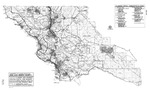
1996 map of San Luis Obispo County, California, showing township and range.
Description
A map of San Luis Obispo County, California, prepared by the Department of Planning and Building, showing township and range, as well as depicting Planning Area Boundary, Coastal Zone Boundary, Urban Reserve Area or Village Reserve Area and County Supervisors District Boundary and District Number.
Source
San Luis Obispo County Department of Planning and Building
Format
PDF File
Language
English
Disciplines
Business | Education | Law | Social and Behavioral Sciences
Original Format
Paper
Document Type
Map
Recommended Citation
"1996 San Luis Obispo County Map - Township and Range" (2016). Groundwater Basin Maps. 12.
https://digitalcommons.csumb.edu/hornbeck_cgb_4/12
Included in
Business Commons, Education Commons, Law Commons, Social and Behavioral Sciences Commons
