
Files
Download Full Text (3.4 MB)
Subject
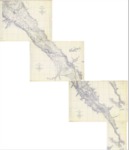
Composite map reflecting USGS surveys made of Salinas Valley, California, between 1908 and 1912.
Description
Composite map of the Salinas Valley, Monterey County, California, made from surveys conducted by the United States Department of the Interior, U. S. Geological Survey during the years 1908 through 1912.
Source
Stetson Engineers, Inc.
Format
PDF File
Language
English
Disciplines
Arts and Humanities | Education | Law | Social and Behavioral Sciences
Original Format
Paper
Document Type
Map
Recommended Citation
"1908-1912 -Salinas Valley USGS Composite Map" (2017). Groundwater Basin Maps. 20.
https://digitalcommons.csumb.edu/hornbeck_cgb_4/20
Included in
Arts and Humanities Commons, Education Commons, Law Commons, Social and Behavioral Sciences Commons
