

Files
Download Full Text (12.8 MB)
Subject
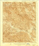
U.S. Geological topographical survey of Junipero Serra Quadrangle.
Description
U.S. Geological topographical survey depicting the Junipero Serra Quadrangle, Monterey County, California, reflecting landmarks, creeks, ranchos, railways and roads.
Source
Early California maps, Monterey surveys, natural resources, cultural resources, historical resources, agriculture
Format
Language
English
Disciplines
Arts and Humanities | Education | Law | Life Sciences | Social and Behavioral Sciences
Original Format
Paper
Document Type
Map
Recommended Citation
"1919 - Junipero Serra Quadrangle Topographical Survey, Monterey CountyU.S. Geological topographical survey of San Luis Obispo Quadrangle. - USGS" (2018). Groundwater Basin Maps. 58.
https://digitalcommons.csumb.edu/hornbeck_cgb_4/58
Included in
Arts and Humanities Commons, Education Commons, Law Commons, Life Sciences Commons, Social and Behavioral Sciences Commons