

Miscellaneous Monterey and San Luis Obispo County Documents and Reports
Files
Subject
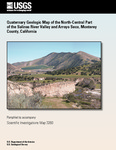
Arroyo Seco, a perennial drainage in the Santa Lucia Range of the Central Coast Range of California, adjacent to the Salinas River Valley.
Description
The new mapping provides a detailed stratigraphic history of incision and deposition from the early Pleistocene to the present. Infiltration from the Salinas River and its tributaries is the source of irrigation water in this agricultural region. Irrigation water is pumped from the aquifers at depths of about 55 and 120 m. Area has become intruded by seawater, especially between cities of Castroville and Salinas.
Source
United States Department of Interior
Format
Language
English
Disciplines
Arts and Humanities | Business | Education | Engineering | Life Sciences | Physical Sciences and Mathematics | Social and Behavioral Sciences
Original Format
Paper
Document Type
Report
Recommended Citation
"2014 - Quarternary Geologic Map of North-Central Salinas River Valley and Arroyo Seco" (2018). Miscellaneous Monterey and San Luis Obispo County Documents and Reports. 32.
https://digitalcommons.csumb.edu/hornbeck_cgb_5/32
Included in
Arts and Humanities Commons, Business Commons, Education Commons, Engineering Commons, Life Sciences Commons, Physical Sciences and Mathematics Commons, Social and Behavioral Sciences Commons