
Title
1858 - Map of the Gadsden Purchase - Sonora and portions of New Mexico, Chihuahua & California
Files
Download Full Text (15.8 MB)
Subject
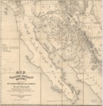
An 1858 map depicting the Gadsden Purchase (1854) and reflecting Sonora and portions of New Mexico, Chihauhau and California.
Description
An 1858 map by Herman Ehrenberg derived from his private notes and others depicts the Gadsen Purchase and reflects Sonora, portions of New Mexico, Chihauhau and California. It shows a number of alternate railway routes between El Paso and Ft. Yuma, as well as reflecting towns, mountains, gold mines, water courses, forts and Indian villages.
Source
Library of Congress
Format
JPG File
Language
English
Disciplines
Arts and Humanities | Education | Social and Behavioral Sciences
Original Format
Paper
Document Type
Map
Recommended Citation
"1858 - Map of the Gadsden Purchase - Sonora and portions of New Mexico, Chihuahua & California" (2017). American Period Maps. 14.
https://digitalcommons.csumb.edu/hornbeck_usa_1/14
