

Files
Download Full Text (241.5 MB)
Subject
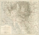
1870 map detailing South-Western United States and Mexican states of Sonora and Chihuahua.
Description
Map detailing the South-Western Portion of the US and the Mexican states of Sonora and Chihuahua to illustrate the Paper by Dr. W. A. Bell regarding his travels and the route he took during 1867-1868. Contains an insert of Lower California.
Source
National Archives
Format
JPG File
Language
English
Disciplines
Arts and Humanities | Education | Law | Social and Behavioral Sciences
Original Format
Paper
Document Type
Article
Recommended Citation
"1870 Map of the South-Western Portion of the United States and of Sonora and Chihuahua" (2016). American Period Maps. 4.
https://digitalcommons.csumb.edu/hornbeck_usa_1/4
Included in
Arts and Humanities Commons, Education Commons, Law Commons, Social and Behavioral Sciences Commons