

-

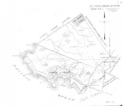
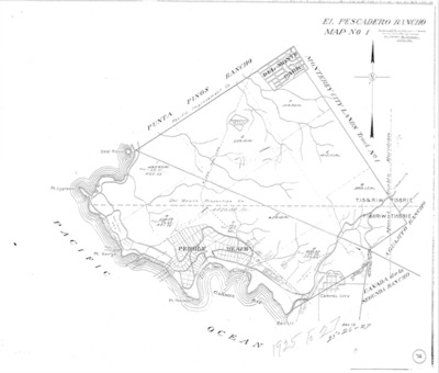
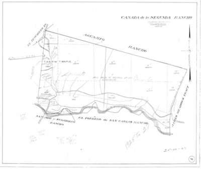
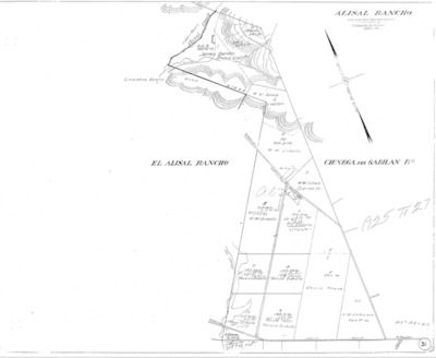
Book No. 422; Township 22S, Range 15E, Map – 1925-1927
Map of Township 22S, Range 15E subdivided for assessment purposes in Monterey County, California for the period 1925-1927.
-

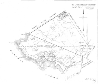
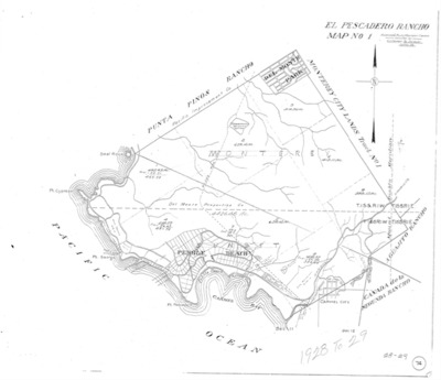
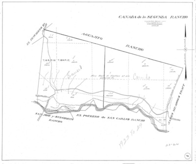
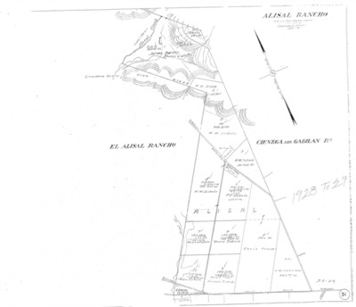
Book No. 422; Township 22S, Range 15E, Map – 1928-1929
Map of Township 22S, Range 15E subdivided for assessment purposes in Monterey County, California for the period 1928-1929.
-

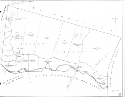
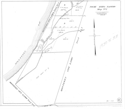
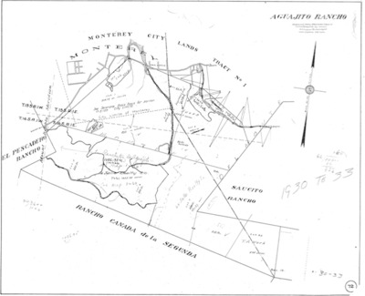
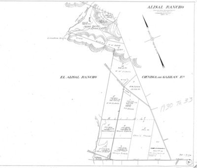
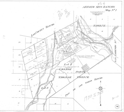
Book No. 422; Township 22S, Range 15E, Map – 1930-1933
Map of Township 22S, Range 15E subdivided for assessment purposes in Monterey County, California for the period 1930-1933.
-

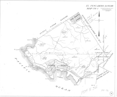
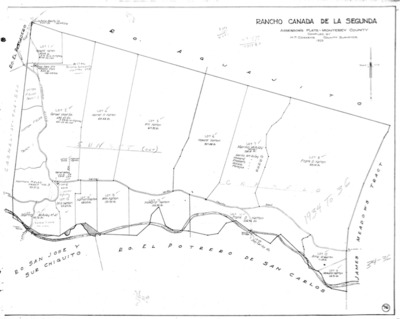
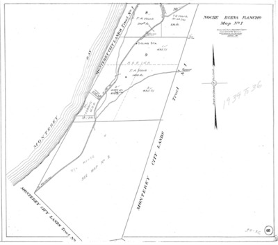
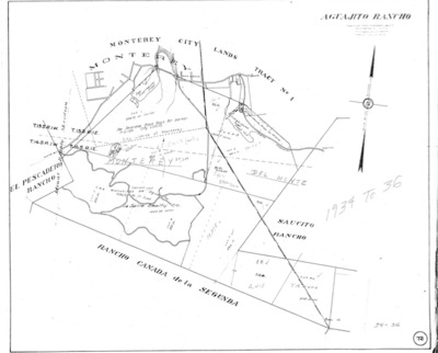
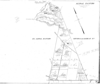
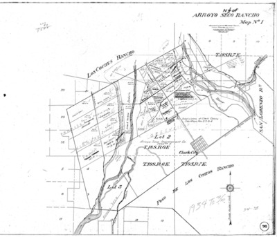
Book No. 422; Township 22S, Range 15E, Map – 1934-1936
Map of Township 22S, Range 15E subdivided for assessment purposes in Monterey County, California for the period 1934-1936.
-

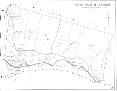
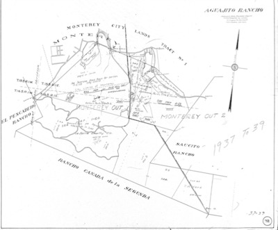
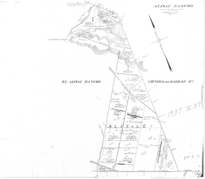
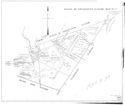
Book No. 422; Township 22S, Range 15E, Map – 1937-1939
Map of Township 22S, Range 15E subdivided for assessment purposes in Monterey County, California for the period 1937-1939.
-

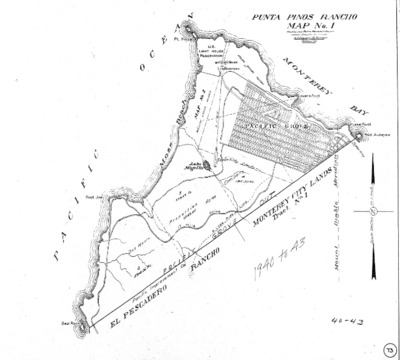
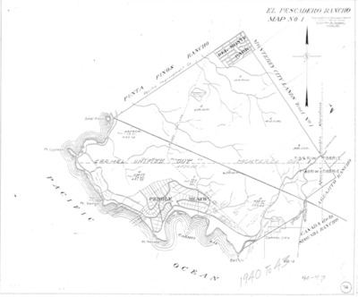
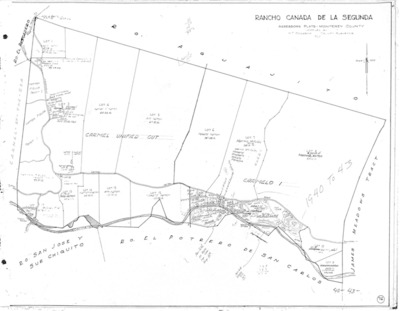
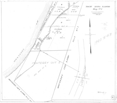
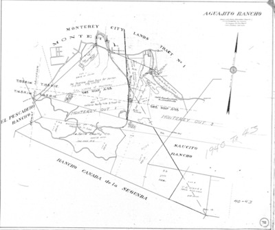
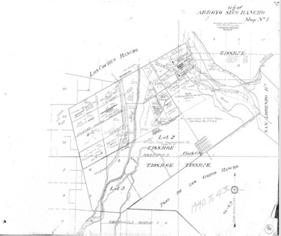
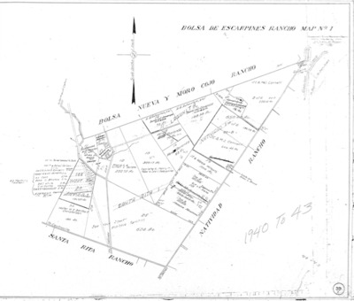
Book No. 422; Township 22S, Range 15E, Map – 1940-1943
Map of Township 22S, Range 15E subdivided for assessment purposes in Monterey County, California for the period 1940-1943.
-

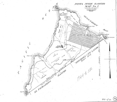
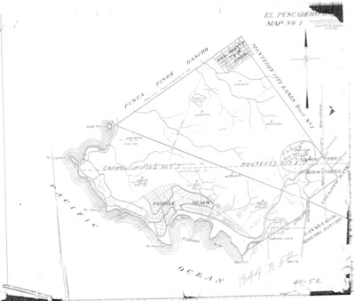
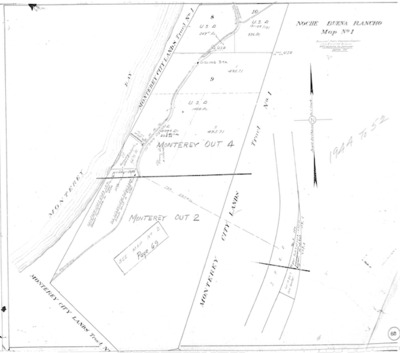
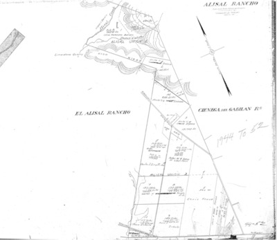
Book No. 422; Township 22S, Range 15E, Map – 1944-1952
Map of Township 22S, Range 15E subdivided for assessment purposes in Monterey County, California for the period 1944-1952.
-

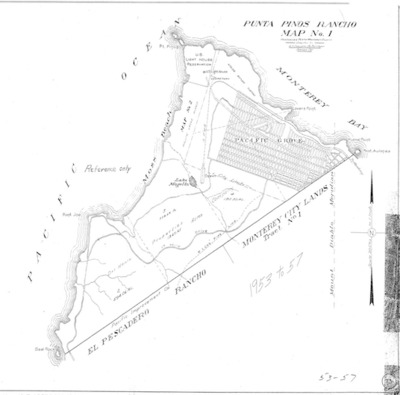
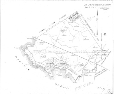
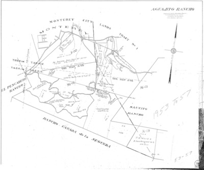
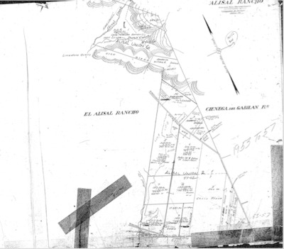
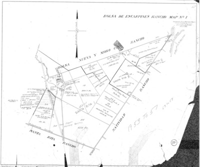
Book No. 422; Township 22S, Range 15E, Map – 1953-1957
Map of Township 22S, Range 15E subdivided for assessment purposes in Monterey County, California for the period 1953-1957.
-

Book No. 423 – T23S, R04E & R05E; Township-Range Map - undated
Map of Township 23S, Range 04E and 05E, subdivided for assessment purposes in Monterey County, California – undated.
-

Book No. 423 – T23S, R08E; Tentative Map for Minor Subdivision of NE 1/4 of the NW 1/4 & the N 1/2 of the NE 1/4 of Section 4 - Sept. 1979
Map of Township 23S, Range 8E, subdivided for assessment purposes in Monterey County, California – Sept. 1979.
-

Book No. 423 – T23S, R08E; Tentative Map for Minor Subdivision of the NW 1/4 of the W 1/4 & the S 1/2 of the NW 1/4 of Section - Sep. 1979
Map of Township 23S, Range 8E, subdivided for assessment purposes in Monterey County, California – Sept. 1979.
-

Book No. 423 – T23S, R14E; Owner's Map, Sections 1, 4-6, 8, 9, 15, 16, 21, 22, 24, 25, 27, 30 - Dec. 1980
Map of Township 23S, Range 14E, subdivided for assessment purposes in Monterey County, California – Dec. 1980.
-

Book No. 423 - T23S, R14E - Parcel Map for Town of Parkfield & Portion of Sec. 26; 23-14B – Undated
Parcel map of Town of Parkfield & portion of Sec. 26; 23-14B, located in Township 23S, Range 14E, in Monterey County, California, subdivided for assessment purposes in Monterey County, California, Undated.
-

Book No. 423 - T23S, R14E - Parcel Map, MS 78-131, Division of S1/2 of SW1/4 of Sec. 15 and W1/2 of NW1/4 of Sec. 22 – Undated
Parcel Map, MS 78-131, Division of S1/2 of SW1/4 of Sec. 15 and W1/2 of NW1/4 of Sec. 22, located in Township 2S3, Range 14E, in Monterey County, California, subdivided for assessment purposes in Monterey County, California, Undated.
-

Book No. 423 - T23S, R14E - Parcel Map of Portion of NW 1/4 of Sec. 26; 23-14A-1 - July 1974
Parcel map of Portion of NW 1/4 of Sec. 26; 23-14A-1 located in Township 23S, Range 14E, in Monterey County, California, subdivided for assessment purposes in Monterey County, California, July 1974.
-

Book No. 423 - T23S, R16E, MDM; Monterey County Assessor Township Plat by Sections - Undated
Map of Township 23S, Range 16E, subdivided for assessment purposes in Monterey County, California, undated.
-

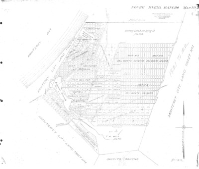
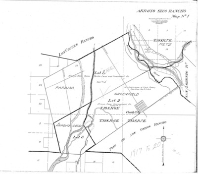
Book No. 423; Township 23S, Range 04-05E, Assessor Township Plat – 1919-1920
Assessor plat of Township 23S, Range 4-5E, subdivided for assessment purposes in Monterey County, California for the period 1919-1920.
-

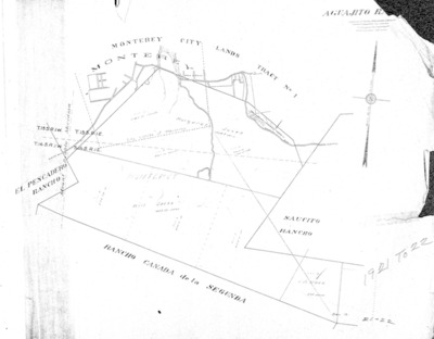
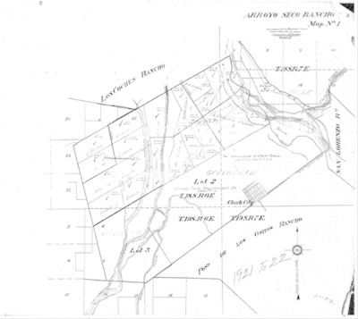
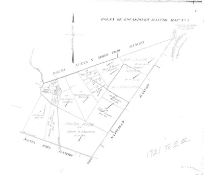
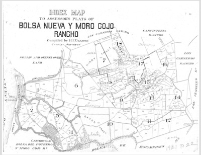
Book No. 423; Township 23S, Range 04-05E, Assessor Township Plat – 1921-1922
Assessor plat of Township 23S, Range 4-5E, subdivided for assessment purposes in Monterey County, California for the period 1921-1922.
-

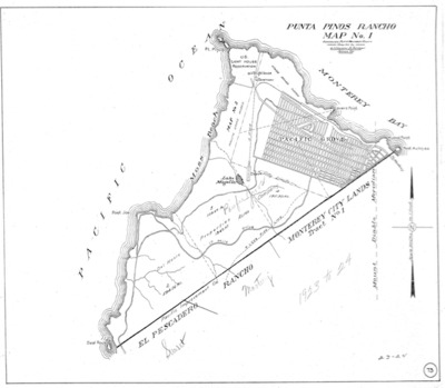
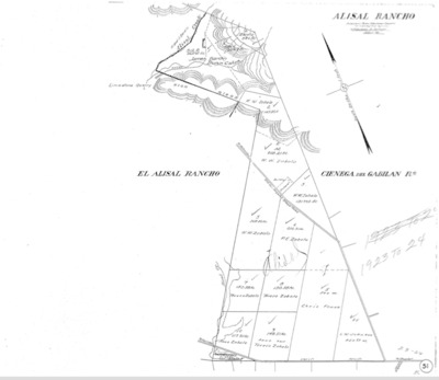
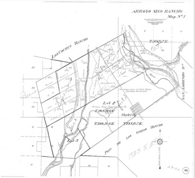
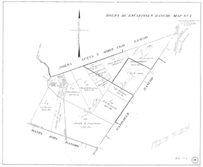
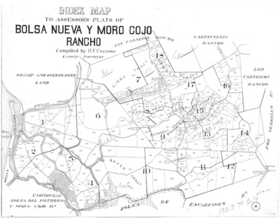
Book No. 423; Township 23S, Range 04-05E, Assessor Township Plat – 1923-1924
Assessor plat of Township 23S, Range 4-5E, subdivided for assessment purposes in Monterey County, California for the period 1923-1924.
-

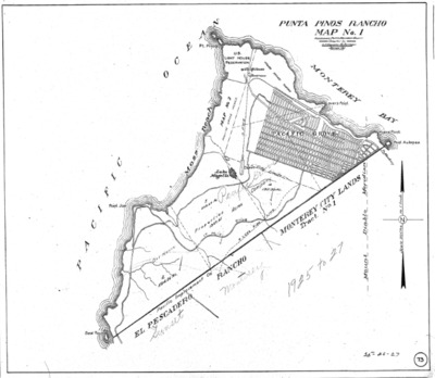
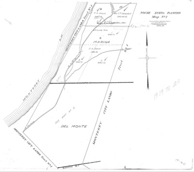
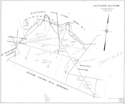
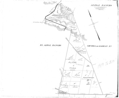
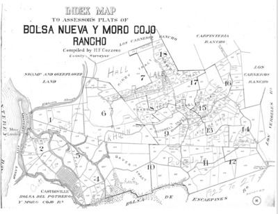
Book No. 423; Township 23S, Range 04-05E, Assessor Township Plat – 1925-1927
Assessor plat of Township 23S, Range 4-5E, subdivided for assessment purposes in Monterey County, California for the period 1925-1927.
-

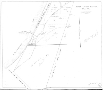
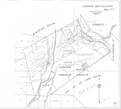
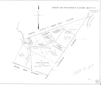
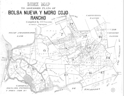
Book No. 423; Township 23S, Range 04-05E, Assessor Township Plat – 1928-1929
Assessor plat of Township 23S, Range 4-5E, subdivided for assessment purposes in Monterey County, California for the period 1928-1929.
-

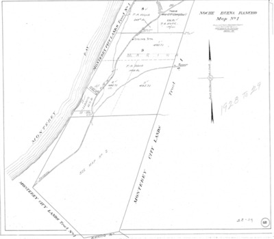
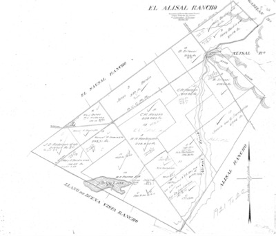
Book No. 423; Township 23S, Range 04-05E, Assessor Township Plat – 1930-1933
Assessor plat of Township 23S, Range 4-5E, subdivided for assessment purposes in Monterey County, California for the period 1930-1933.
-

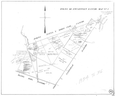
Book No. 423; Township 23S, Range 04-05E, Assessor Township Plat – 1934-1936
Assessor plat of Township 23S, Range 4-5E, subdivided for assessment purposes in Monterey County, California for the period 1934-1936.
-

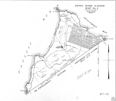
Book No. 423; Township 23S, Range 04-05E, Assessor Township Plat – 1937-1939
Assessor plat of Township 23S, Range 4-5E, subdivided for assessment purposes in Monterey County, California for the period 1937-1939.
-

Book No. 423; Township 23S, Range 04-05E, Assessor Township Plat – 1940-1943
Assessor plat of Township 23S, Range 4-5E, subdivided for assessment purposes in Monterey County, California for the period 1940-1943.
Printing is not supported at the primary Gallery Thumbnail page. Please first navigate to a specific Image before printing.