

Files
Download Full Text (11.9 MB)
Subject
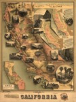
1888 map by the Southern Pacific Railroad Company and the California State Board of Trade as part of a campaign to promote the economic, cultural, and natural advantages of California as a place in which to live and invest.
Description
This 1888 map covers the entire state, with insets showing temperature, soil, land area, and scenic images. Annual rainfall in inches is indicated by circled numbers across the map. An inset at the top shows a cross-section of the Sierra Nevada Mountains and the elevation in feet of some of the famous peaks (the heights differ from more accurate present-day measurements). The map charts the main existing railroads (especially Southern Pacific Company’s routes), and emphasizes key products from various regions of California. An inset highlights the size of California, showing that its land mass is larger than that of ten other states combined. Vignettes highlight iconic scenes from the state, including both natural wonders and urban landmarks. Among the natural vistas shown are the Yosemite Valley, Lassen Peak, Mount Whitney, Lake Tahoe, the redwoods, and the Golden Gate.
Source
Library of Congress
Format
JPG File
Language
English
Disciplines
Arts and Humanities | Education | Social and Behavioral Sciences
Original Format
Paper
Document Type
Map
Recommended Citation
"1888 – The Unique Map of California" (2017). American Period Maps. 17.
https://digitalcommons.csumb.edu/hornbeck_usa_1/17