

Files
Download Full Text (1.2 MB)
Subject
Maps of Mexico and California
Description
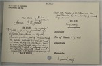
Handwritten and typed index cards providing location in National Archives and details regarding maps of Mexican and Californian:
Early Spanish map embracing frontiers of his majesty's (Spanish) territories in North America
1804 General map of the Kingdom of New Spain
Second edition (1846) of 1832 map of the United States of Mexico Republic
1849 California, Chart of the coast from San Blas to San Francisco, James Imray
1916 Map of Mexico issued by Southern Department of Army Continental Command for War College
Source
U.S. National Archives, Maryland
Format
PDF File
Language
English
Disciplines
Arts and Humanities | Education | Law | Social and Behavioral Sciences
Original Format
Paper
Document Type
Article
Recommended Citation
"Index Cards of Maps of Mexico and California" (2016). National Archives Documents. 9.
https://digitalcommons.csumb.edu/hornbeck_usa_2_a/9
Included in
Arts and Humanities Commons, Education Commons, Law Commons, Social and Behavioral Sciences Commons