

-

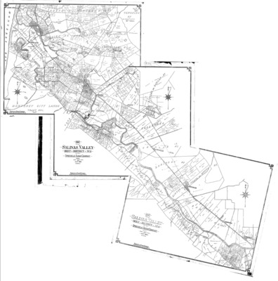
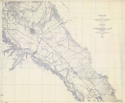
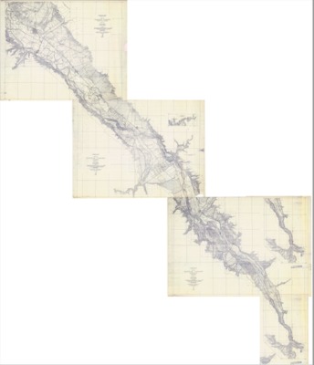
1908-1912 -Salinas Valley USGS Composite Map
Composite map of the Salinas Valley, Monterey County, California, made from surveys conducted by the United States Department of the Interior, U. S. Geological Survey during the years 1908 through 1912.
-

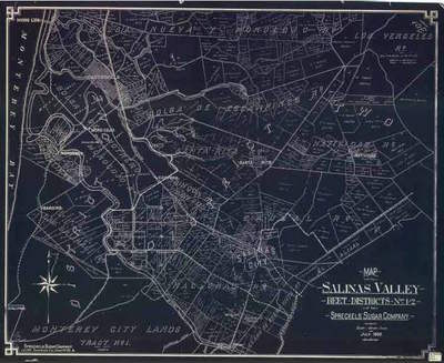
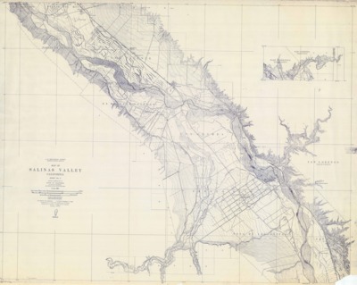
1910-1912 Salinas Valley Map, Sheet 2
A 1910-1912 survey map of the Salinas Valley, Monterey County, California, prepared by the United States Department of the Interior, U. S. Geological Survey.
-

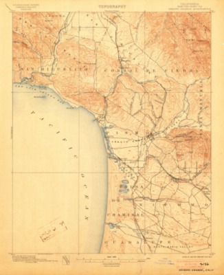
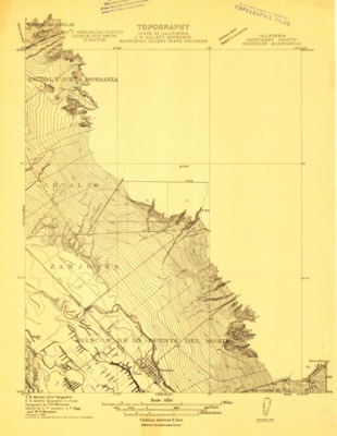
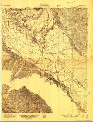
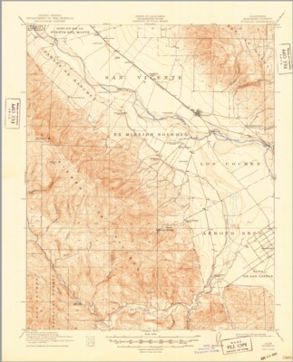
1910 - Gonzales Quadrangle Topographical Survey, Monterey County - USGS
A 1910 U.S. Geological topographical survey depicting the Gonzales Quadrangle, Monterey County, California, reflecting landmarks, creeks, ranchos, railways and roads.
-

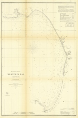
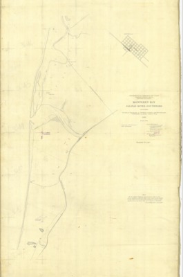
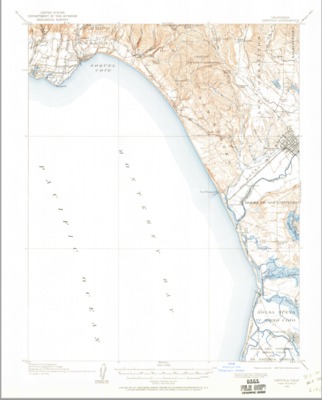
1910 - Monterey Bay, Salinas River Southward - Monterey County, CA
A 1910 US Coast and Geodetic survey of the Monterey Bay area from the Salinas River southward.
-

1910 - Salinas Quadrangle Topographical Map, Monterey Co. - USGS
A 1910 U.S. Geological topographical survey depicting the Salinas Quadrangle, Monterey County, California, reflecting landmarks, Salinas River, creeks, ranchos, railways and roads.
-

1912 - Capitola Quadrangle Topographical Survey, Monterey and Santa Cruz Counties - USGS
A 1910 U.S. Geological topographical survey depicting the San Luis Obispo Quadrangle, Monterey and Santa Cruz counties, California, reflecting landmarks, Salinas River, creeks, ranchos, railways and roads.
-

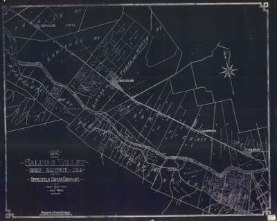
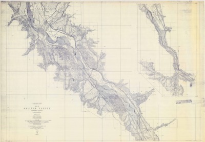
1912 Salinas Valley Map, Sheet 3
1912 survey map of the Salinas Valley, Monterey County, California, prepared by the United States Department of the Interior, U. S. Geological Survey.
-

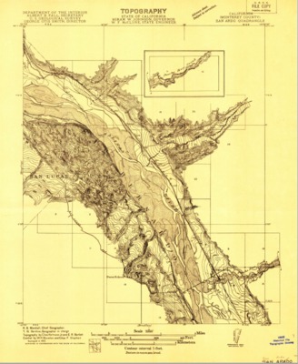
1912 - San Ardo Quadrangle Topographical Survey, Monterey Co. - USGS
A 1912 U.S. Geological topographical survey depicting the San Ardo Quadrangle, Monterey County, California, reflecting landmarks, Salinas River, creeks, ranchos, railways and roads.
-

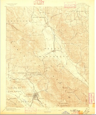
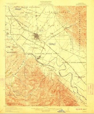
1912 U.S. Geological Survey of the Salinas Quadrangle, Monterey County, California
A 1912 U.S. Geological topographical survey depicting the Salinas Quadrangle in Monterey County, California, also reflecting landmarks, ranchos, railways, schools and communities.
-

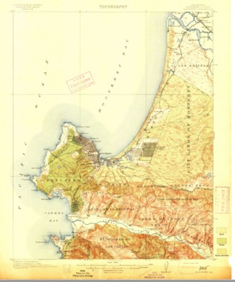
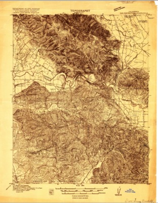
1913 - Monterey Quadrangle Topographical Survey, Monterey, CA - USGS
A 1913 U.S. Geological topographical survey depicting the Monterey Quadrangle, Monterey County, California, reflecting landmarks, creeks, ranchos, railways and roads.
-

1913 U.S. Geological Survey of the Monterey Quadrangles, Monterey County, California
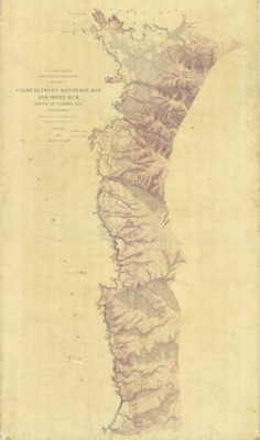
A 1913 U.S. Geological topographical survey depicting the Monterey Quadrangle in Monterey County, California covering the region from Point Lobos and the Carmel Valley north to the mouth of the Salinas River.
-

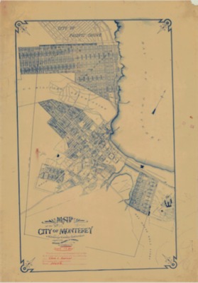
1915 - Map of the City of Monterey - City Plan, Monterey County, California
The 1915 map of the City of Monterey depicts the proposed plan for that city, as well as the initial layout for the City of Pacific Grove.
-

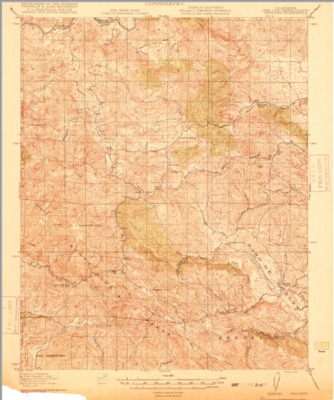
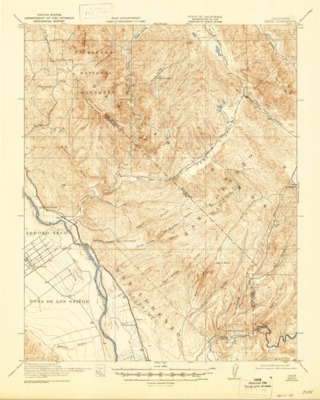
1915 - Priest Valley Quadrangle Topographical Survey, Monterey and San Benito Counties - USGS
An 1897 U.S. Geological topographical survey depicting the Priest Valley Quadrangle, Monterey and San Benito counties, California, reflecting landmarks, Salinas River, creeks, ranchos, railways and roads.
-

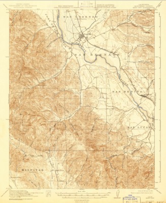
1915 - San Juan Bautista Quadrangle Topographical Survey, Santa Cruz, Monterey and San Bonita Counties - USGS
An 1897 U.S. Geological topographical survey depicting the San Juan Bautista Quadrangle, Santa Cruz, Monterey and San Benito Counties, California, reflecting landmarks, creeks, ranchos, railways and roads.
-

1915 - Soledad Quadrangle Topographical Survey, Monterey County - USGS
1915 U.S. Geological topographical survey depicting the Soledad Quadrangle, Monterey County, California, reflecting landmarks, Salinas River, creeks, ranchos, railways and roads.
-

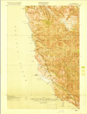
1918 - Point Sur Quadrangle Topographical Survey, Monterey County - USGS
1918 U.S. Geological topographical survey depicting the Point Sur Quadrangle, Monterey County, California, reflecting landmarks, creeks, ranchos, railways and roads.
-

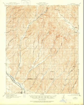
1919 - Adelaida Quadrangle Topographical Survey, San Luis Obispo County - USGS
1919 - U.S. Geological topographical survey depicting the Adelaida Quadrangle, San Luis Obispo County, California, reflecting landmarks, creeks, ranchos, railways and roads.
-

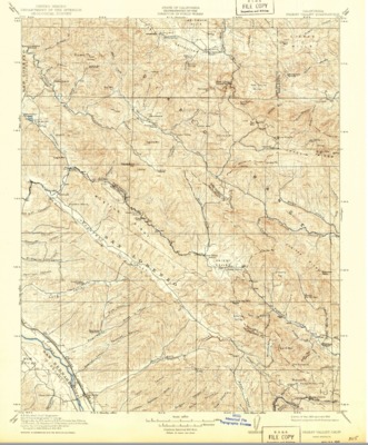
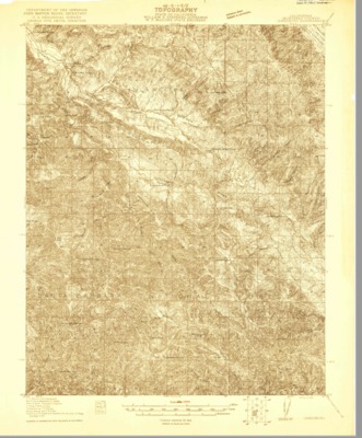
1919 - Bradley Quadrant Topographical Survey, Monterey and San Luis Obispo Counties - USGS
1919 U.S. Geological topographical survey depicting the Bradley Quadrangle, Monterey and San Luis Obispo counties, California, reflecting landmarks, Salinas River, creeks, ranchos, railways and roads.
-

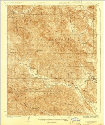
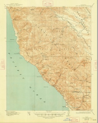
1919 - Bryson Quadrangle Topographical Survey, Monterey County - USGS
A 1919 U.S. Geological topographical survey depicting the Bryson Quadrangle, Monterey County, California, reflecting landmarks, creeks, ranchos, railways and roads
-

1919 - Capitola Quadrangle Topographical Survey, Santa Cruz and Monterey Counties - USGS
1919 U.S. Geological topographical survey depicting the Capitola Quadrangle, Santa Cruz and Monterey counties, California, reflecting landmarks, creeks, ranchos, railways and roads.
-

1919 - Junipero Serra Quadrangle Topographical Survey, Monterey CountyU.S. Geological topographical survey of San Luis Obispo Quadrangle. - USGS
U.S. Geological topographical survey depicting the Junipero Serra Quadrangle, Monterey County, California, reflecting landmarks, creeks, ranchos, railways and roads.
-

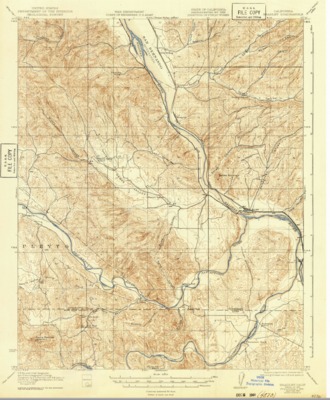
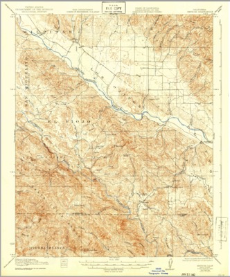
1919 - King City Quadrangle Topographical Survey, Monterey County - USGS
U.S. Geological topographical survey depicting the King City Quadrangle, Monterey County, California, reflecting landmarks, Salinas River, creeks, ranchos, railways and roads.
-

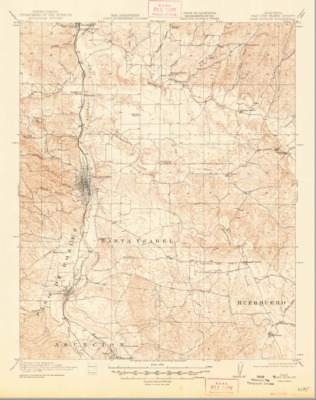
1919 - Paso Robles Quadrangle Topographical Survey, San Luis Obispo County - USGS
A 1919 Geological topographical survey depicting the Paso Robles Quadrangle, San Luis Obispo County, California, reflecting landmarks, Salinas River, creeks, ranchos, railways and roads.
-

1919 - San Miguel Quadrangle Topographical Survey, Monterey and San Luis Obispo Counties - USGS
U.S. Geological topographical survey depicting the San Miguel Quadrangle, Monterey and San Luis Obispo counties, California, reflecting landmarks, Salinas River, creeks, ranchos, railways and roads.
-

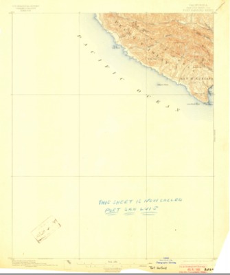
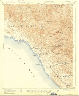
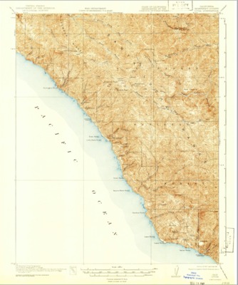
1919 - San Simeon Quadrangle Topographical Survey, San Luis Obispo County - USGS
A 1919 U.S. Geological topographical survey depicting the SanSimeon Quadrangle, San Luis Obispo County, California, reflecting landmarks, creeks, ranchos, railways and roads.
Printing is not supported at the primary Gallery Thumbnail page. Please first navigate to a specific Image before printing.